N3UJJ Weather Station Website MastHead
If you like my site, Please give me a +1
National SkyWarn Spotter
NOAA MesoWest MADIS
ID: AAE45
ID: AS693

Latest NOAA Weather Satellite Images
Focusing on the East Coast of the United States

N3UJJ Weather Station in Lothian, Maryland, 20711

Serving Boones Estates, Waysons Corner, Lothian MD
Chesapeake Bay and Maryland C
ommunities for over 5 Years

This shows the most recent image of the United States, taken from a NOAA satellite. This image is taken in visible light, or how the human eye would see from the satellite. Sunrise and set can be tracked in this image.

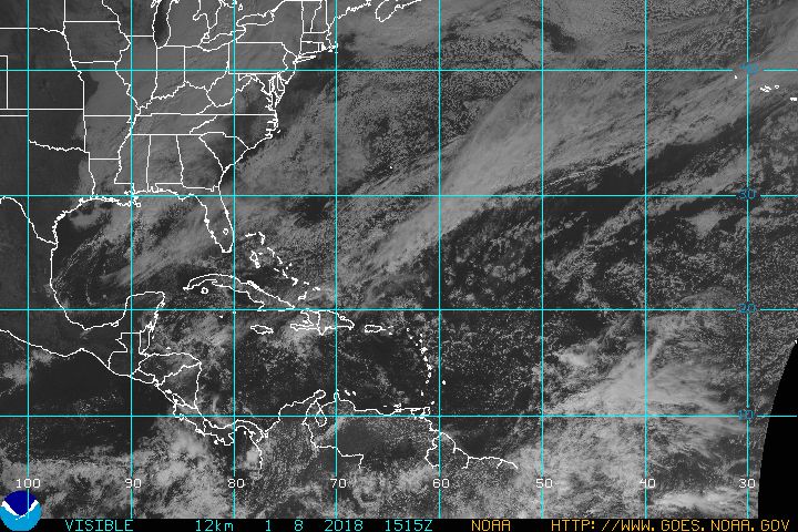
GOES Imagery Visible
This shows the most recent image of the United States, taken from a NOAA satellite. This image is taken in visible light, or how the human eye would see from the satellite. Sunrise and set can be tracked in this image.

This shows the most recent image of the United States, from a NOAA satellite. This image is taken using a wavelength sensitive to the content of water vapor in the atmosphere. Bright and colored areas indicate high water vapor (moisture) content (colored and white areas indicate the presence of both high moisture content and/or ice crystals). Black and brown areas indicate little or no moisture present. WV imagery is useful for both determining locations of moisture and atmospheric circulations.

GOES Imagery Water Vapor
This shows the most recent image of the United States, from a NOAA satellite. This image is taken using a wavelength sensitive to the content of water vapor in the atmosphere. Bright and colored areas indicate high water vapor (moisture) content (colored and white areas indicate the presence of both high moisture content and/or ice crystals). Black and brown areas indicate little or no moisture present. WV imagery is useful for both determining locations of moisture and atmospheric circulations.

Atlantic Sector (IR Ch 4)

Hurricane Tracking Sector (VIS)

GOES East FULL DISK (Visible Light)

GOES East FULL DISK (Infrared)

From 35,800 kilometers (22,300 miles) above Earth, NOAA's two GOES satellites provide half-hourly observations of Earth and its environment.
Visible imagery provides highly detailed cloud information during daylight hours, whereas infrared imagery provides more information about cloud and atmospheric properties and is available around the clock.

Click Here for a HIGH-DEF 3 Day Time Lapse of the above image


Cell 01
Scott Gillis (N3UJJ) Page Counter
Cell 02
Cell 01
Cell 02
Cell 03

My QTH
(Home Location)

Grid Square: FM18PT83OV

CQ Zone 5
I.T.U Zone 8

Latitude: 38.90970253171965
Longitude: -76.51880979537964

Latitude: N38°48.47'
Longitude: W76°40.70'

Latitude: 38.910°
Longitude: -76.519°

Footer last updated: October 15, 2023 9:50 -->